The Humps are one of the three major metric Relative Hills Lists of Britain adopted by the Relative Hills Society covering hills with less prominence than the Marilyns.
Since their prominence is lower, we will see that Humps have a wider geographic distribution and may take you to more novel places based on their history or difficulty.
In this introduction, we explain what the Humps are, how they originated, why they appeal and give some suggestions of how to get started in visiting and logging them.
Definition - What is a Hump?
 Humps are defined as British hills with more than 100 metres of prominence.
Hill prominence refers to the relative height compared to surrounding hills. This explanation of hill prominence compares Humps which are sometimes abbreviated to P100s with Tumps (P30) and The Marilyns (P150).
The Humps also include Marilyns since every Marilyn is also a Hump. Or you could say that the Marilyns are a subset of the Humps with more prominence.
Since Humps are hills with one hundred metres of prominence, they are sometimes written as HuMPs (Hundred and upwards Metre Prominence), but Hump is usually used for simplicity.
The origin and history of Humps
 In 2009, some 17 years after the publication of Alan Dawson's The Relative Hills of Britain, Mark Jackson published a list of the Humps, the next level down from the Marilyns. In ‘More Relative Hills of Britain’ Mark collated information from many other collaborators in the Relative Hills of Britain community to give a comprehensive listing of these hills. The book is available as a free download, updated to 2010.
Mark moved away from the traditional Sections used by the SMC for the Munros and by Alan Dawson for the Marilyns which were based around roads and political boundaries. Instead, he introduced Topo sections based, as the name suggests, on the topography of the country.
A similar list of Scottish hills with 100m prominence had been published in 1989 by E J Yeaman in his ‘Handbook of the Scottish Hills’.
He states in his introduction that
"For the purposes of this Handbook, a hill is defined as an eminence which has an ascent of 100m all round or, failing that, is at least 5km (walking distance) from any higher point on neighbouring hills."
Note that the 5km requirement is not used to define Humps.
A couple of quirky feature are the rating of the difficulty of climbs by the number of chocolate bars required to get you to the top of the hill and the hills being sorted by the Ordnance Survey map that they appear on.
A further list was researched by Clem Clements for England and Wales along the same lines (now published on the Haroldstreet website). Together with Alan Dawson’s work on the Marilyns, these formed the basis of Mark’s book.
Clem Clements and Jim Bloomer later researched the Irish Humps which can be found on the Hill Bagging site.
How many Humps are there?
There are currently 2985 Humps in Britain (including the Channel Islands and the Isle of Man) but, as explained below, this number does fluctuate.
You can check the latest total and those local to you on the Hill Bagging Humps List page which gives a breakdown by countries, counties and Relative Hills sections.
The Haroldstreet Humps pages gives other options for visualising them, cataloguing ascents and GPS waypoints.

There are usually several additions, relocations, renamings, and demotions of Humps each year with ongoing surveying by RHSoc members and other enthusiasts. The latest changes to Humps are recorded by the Database of British and Irish Hills (DoBIH) in their Humps change register.
The challenge of the Humps
The Humps, like the Tumps, offer Relative Hill baggers greater choice due to their wider geographical distribution throughout Great Britain than the Marilyns. This appeals since there are more local Humps that can be climbed with less travel than Marilyns.
Their lower prominence means that they are more numerous than Marilyns in any county. Unlike the Tumps, Hill Bagging doesn't currently offer a list of Humps by county, instead it offers Humps by Topo section.
Since some Humps were chosen as sites for castles for defending and watching over the local area, they can be more historically interesting places to visit than a bleak moorland hill. For example, Mow Cop is the southernmost outcrop in Cheshire of hard sandstone grit rising 355m above sea level. It's owned by the National Trust who note that the mock tower that was built as a summer house in 1754 by Randle Wilbraham, the local Lord of the Manor was the location for the first Primitive Methodist service in 1807.
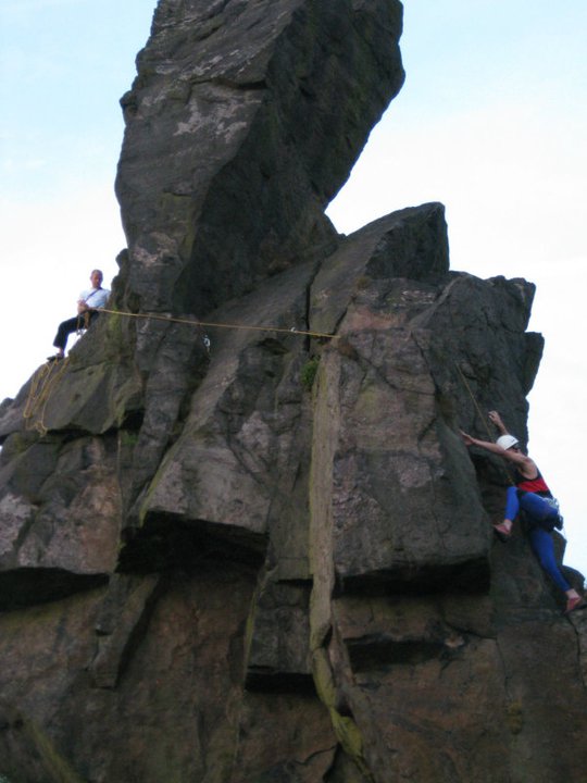
Unfortunately, the high point of Mow Cop is not actually the Summer House or Trig Point but the 'Old Man of Mow', a rock tower isolated during quarrying in the last century. It is a Very Severe rock climb which has been ascended by a few Hump baggers, but not by most National Trust visitors...

Numbers of active Hump baggers
As with the Marilyns and Tumps, there is a Hump Hall of Fame. Since there are roughly twice as many Humps compared to Marilyns, the Hall of Fame entry level is set at 1200 whilst the Upper Hall is set at 2000. Currently around 100 hill baggers have claimed membership.
So far, there have been two completers of the Humps: Rob Woodall, of Peterborough, and Alan Whatley, of Derby, who reached the top of the 137m Old Man of Hoy in the Orkney islands in July 2018. This was their 2985th, and final, summit of a Hump and they touched the summit cairn at the same time.

The Society also offer awards for those climbing either all the English Humps or all the Welsh Humps - and you do not have to do the Old Man of Mow to collect one of these.
Geographical distribution in the UK
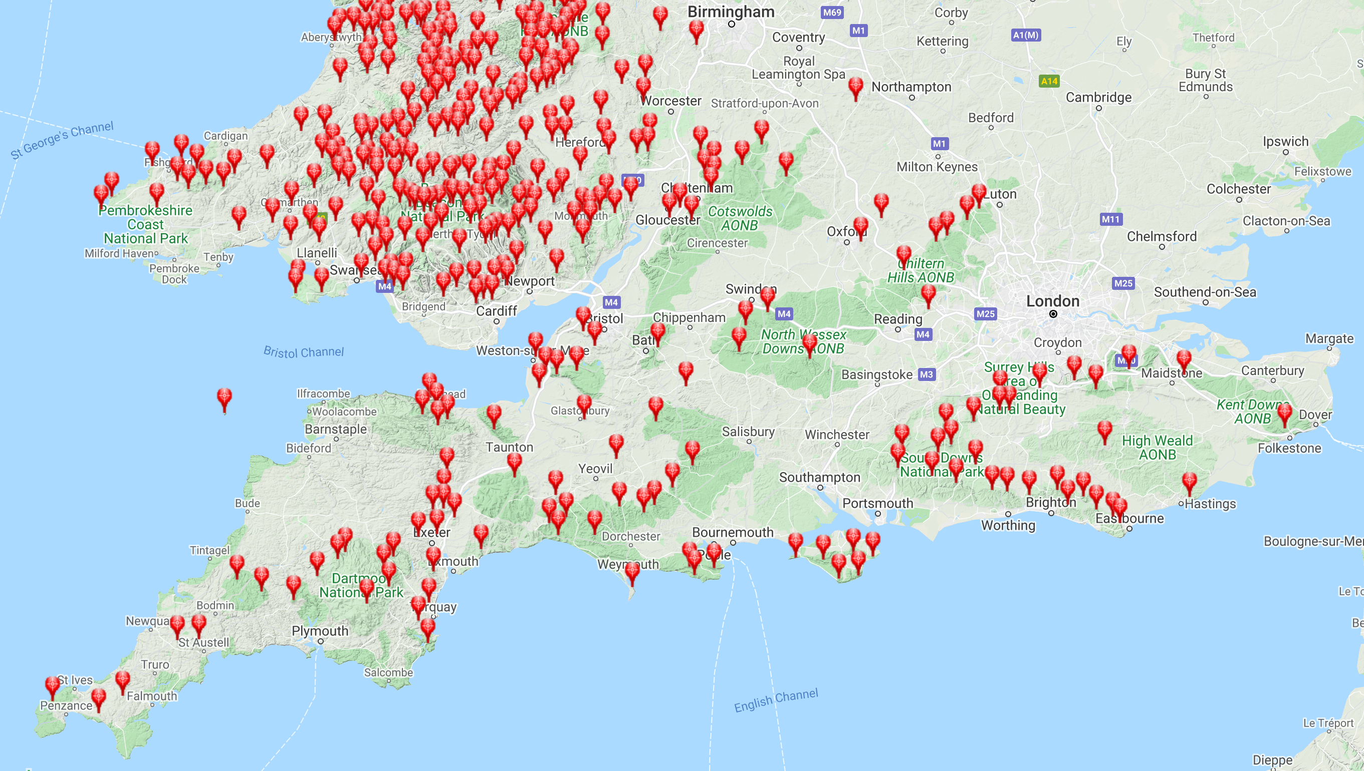
Like the Tumps, the Humps are distributed throughout the UK. There are fewer options for viewing where the Humps are located compared to the Tumps. In Hill Bagging the main options are Relative Hills of Britain Marilyn sections and Topo sections. Humps are also catalogued in sections for Ireland on the Hill Bagging site.
