An article for the Mountaineering Scotland journal 'Scottish Mountaineer' by Jenny Hatfield sharing her experience of completing The Marilyns
Most people have heard of the Munros, the 282 mountains in Scotland over 3,000ft, listed originally by Sir Hugh Munro over 100 years ago.
Not as many have heard of The Marilyns, the 1556 hills in Britain with a 150 metre (492ft) drop on all sides. The highest is Ben Nevis (1345m, 4411ft); the lowest is Maol Domhnaich (Muldoanich) (154m, 505ft) in the Barra Islands archipelago in the Outer Hebrides. After completing the Munros, many Munroists turn to Marilyns and the possibilities are endless. The journey through the Marilyns takes the mountaineer to every corner of Britain, including St Kilda, as discussed by Jenny Hatfield below. The Marilyn list was compiled by Alan Dawson who published ‘The Relative Hills of Britain’ in 1992.
Nearly 7,000 people have completed the Munros, but only 11 people have completed the Marilyns, and only one woman has; Jenny Hatfield. For most, a more realistic target is the Marilyn Hall of Fame (HOF) open to anyone who has completed 600 or more Marilyns. There are currently just under 400 members of this group.
Jenny Hatfield is a member of Mountaineering Scotland and of the Relative Hills Society (RHSoc). This article shares the story of how she completed the Marilyns focusing on her experiences on hill bagging on St.Kilda …. The published magazine article is online here.
The hill bagging challenge of St.Kilda
The St Kilda Archipelago lies 65 kilometres west of the nearest land in the Outer Hebrides, a lonely cluster of islands washed by the wild weather and seas of the Atlantic Ocean. It became one of Scotland’s six World Heritage Sites in 1986 and is one of the few in the world to hold mixed status for both its natural and cultural qualities. The larger islands of Hirta, Dun, Soay and Boreray all rise to over 150m and therefore have Marilyn tops. In addition, the two sea Stacs, Stac Lee and Stac an Armin are both tall enough to class as Marilyns. So with six Marilyns in total, the St Kilda Isles present an inviting, and extraordinarily challenging goal for all Marilyn baggers. Day trips run to the main island of Hirta during the summer months from Lewis and Harris, weather permitting, so Hirta’s highpoint, Conachair (430m), makes a relatively easy target: But what of the other five St Kilda Marilyns?
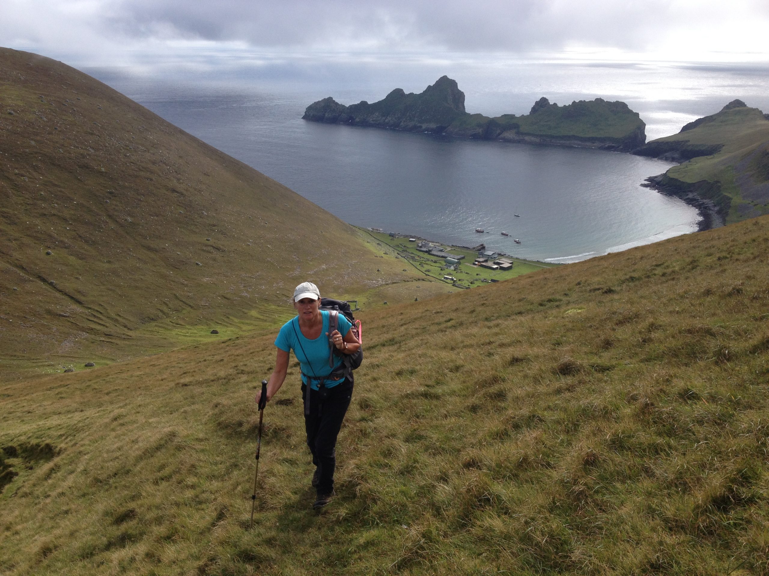
The first four St.Kilda island summits
My first experience of St Kilda, in September 2015, was unforgettable. An early morning start at Leverburgh, loading camping gear onto one of Sea Harris’ boats, The Enchanted Isle: Then a somewhat bumpy crossing, with the islands slowly coming into view on a grey horizon. I was on a three-day excursion with the Relative Hills Society (RHSoc), who organise the trip through the local boatmen, and the National Trust for Scotland (NTS), which oversees the wellbeing of the one million breeding birds on the islands. It was a trip of a lifetime, a trip I had been longing to make since reading about the life of St Kilda Islanders way back in my teens. The islands certainly lived up to expectations. History and wildlife abound, and the sheer cliffs and rock formations of these ancient volcanic isles are breathtakingly spectacular.
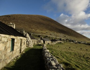
The campsite is a simple field, along from the old village street, surrounded by the dry-stone walls, storage cleits and sprightly Soay sheep. We had brought all our supplies with us for the three days and had permission to camp: No shops on Hirta! But there is a small shower and toilet block, and one of the old croft houses is now the museum, filled with wonderful photos of life as it used to be before the villagers left in the 1930s.
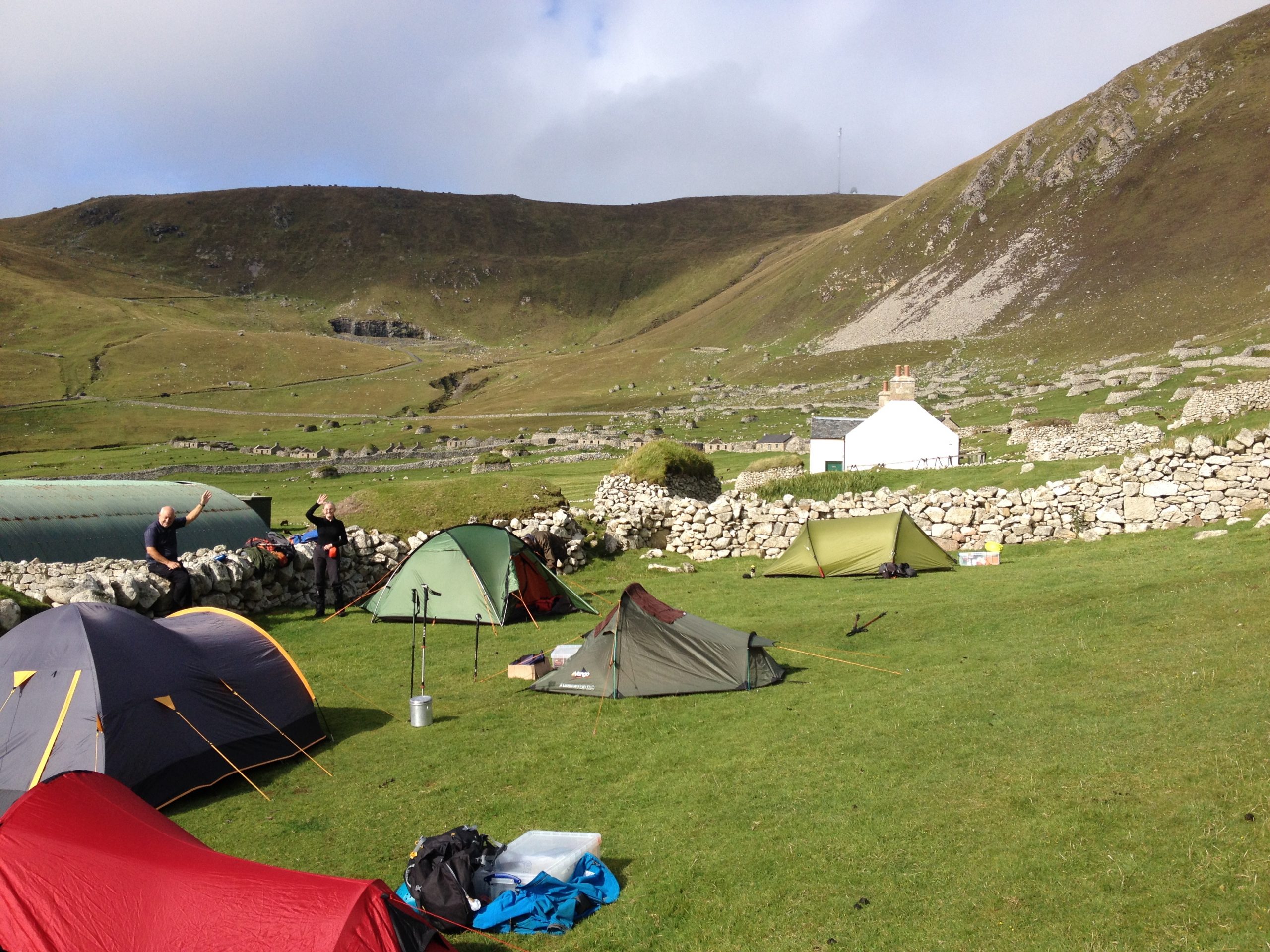
We were a group of twelve, all keen to reach the tops of the Hirta and the three outliers. However, the weather that first day was not encouraging. For us to be able to land on Dun, Soay and Boreray, tide, wind, and swell all have to be taken into account. There are no landing stages and few points on the steep, rocky shores suitable to pull a small tender up safely. The waves were washing into Village Bay, and even Dun, just across the bay, was out of bounds. Nevertheless, we had plenty of time to explore Hirta, with views to the north-east of pinnacled Boreray, with its two massive sea Stacs in attendance, and to the north-west of Soay, and the sheer climb we would need to make to reach its summit.
The next day dawned misty, but just calm enough to make the tricky landing on Boreray. Microspikes on the feet are essential when making the leap from tender to slimy wave-washed rock. A short scrambling section leads to a vertiginous, mist soaked grassy slope. Proceed with caution! The summit ridge, once reached, was narrow and rocky, though no major difficulties and we were soon at the cloud-cloaked summit, Mullach an Eilein (384m).
The weather improved enough for a landing on Dun in the afternoon: Different in character to Boreray, but with its own challenges. Slippery rocks, deep vegetation around the now deserted puffin colony, then a steep, knife-edge ridge to reach the grassy summit, Bioda Mor (178m).
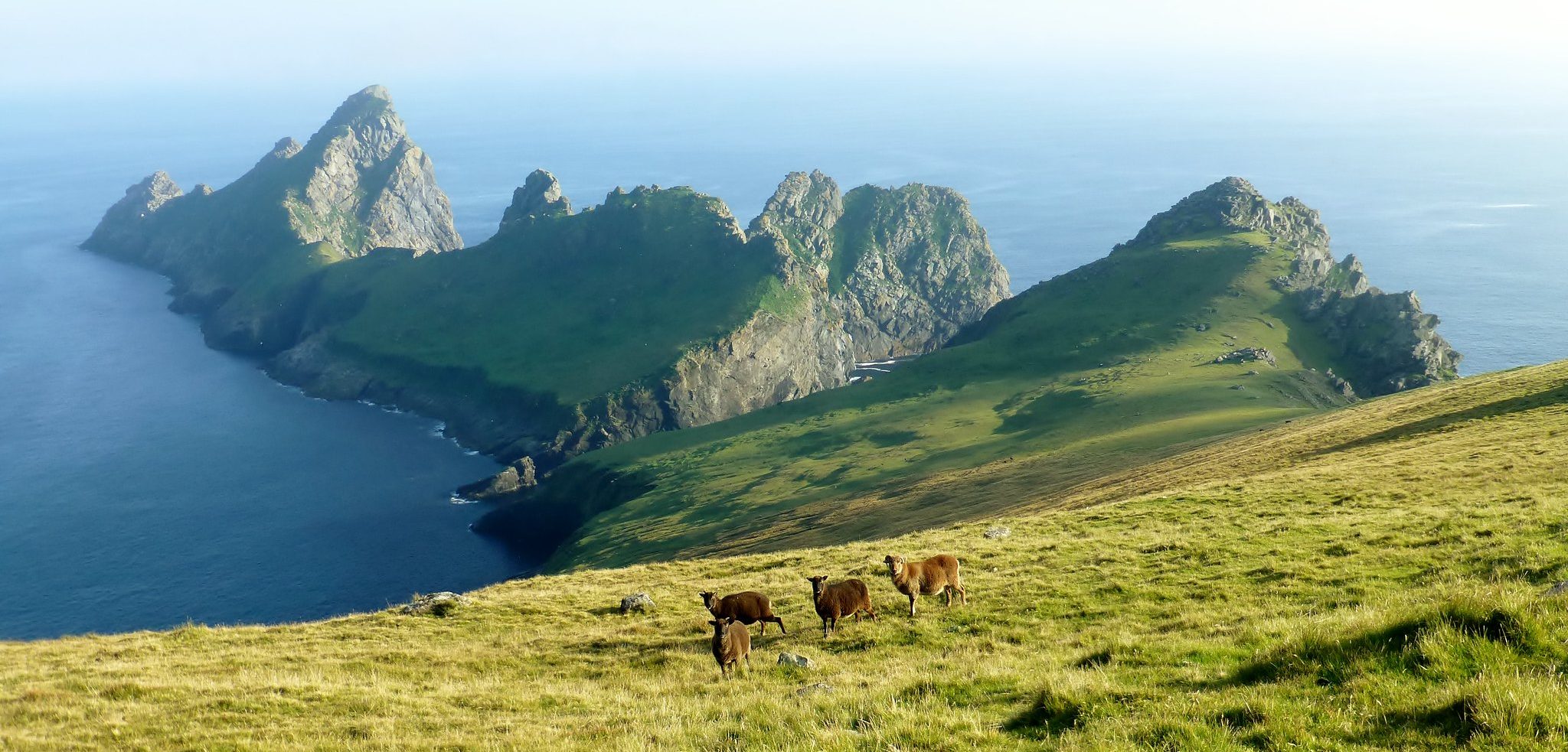
That just left us Soay for the final morning. Another early start, packing the boat ready to leave for Leverburgh, and then we were off. The views of Dun with its rock arches, and the dramatic cliffs of Hirta thrilled us on the ride round to Soay. Then the hard work began: A relatively easy landing, but then a short climbing section before heading up into an area of precipitous scree and rockfall. The knack was to get out of this as soon as possible, heading across to grassier slopes, dotted with cleit shelters built by the hardy St Kildans. Once up the steep side of the island, the top was plateau-like, grazed by Soay sheep, and the summit, Cnoc Glas (376m) was easily reached.

Climbing the St.Kilda Stac Marilyns
I was fortunate enough on that trip to reach the top of the four main islands: Four St Kilda Marilyns conquered! But what of the other two, the infamous sea Stacs, Stac Lee (172m) and Stac An Armin (196m). I say infamous, because it is recognised that simply getting landed on either of these rocky outcrops is a huge challenge, even before you start the climb. Access to the Stacs is only permitted by the NTS during the winter months, when the gannet colonies have vacated. Getting a suitable weather window between mid-October and early March is pretty unlikely. But luck would have it that towards the end of October the same year, such a weather window arose.
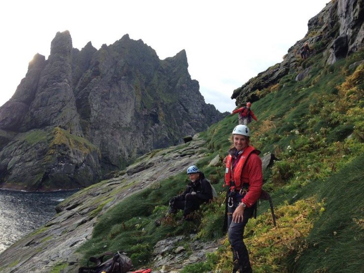
Taking that leap onto Stac Lee must be the most memorable moment of my life: Unbelievable; an ambition come true. It is a brooding lump of a sea stack, even from a distance imposing, and close up, downright frightening! Again, there were twelve of us on this expedition organised by RHSoc using the Sea Harris Company again: All competent climbers, our climbing gear had to be ferried across to us via tender from The Enchanted Isle. I climbed in a rope of four, a narrow scrambling ledge to start. Then the crux pitch: Exposed and out of balance, but not too difficult technically.
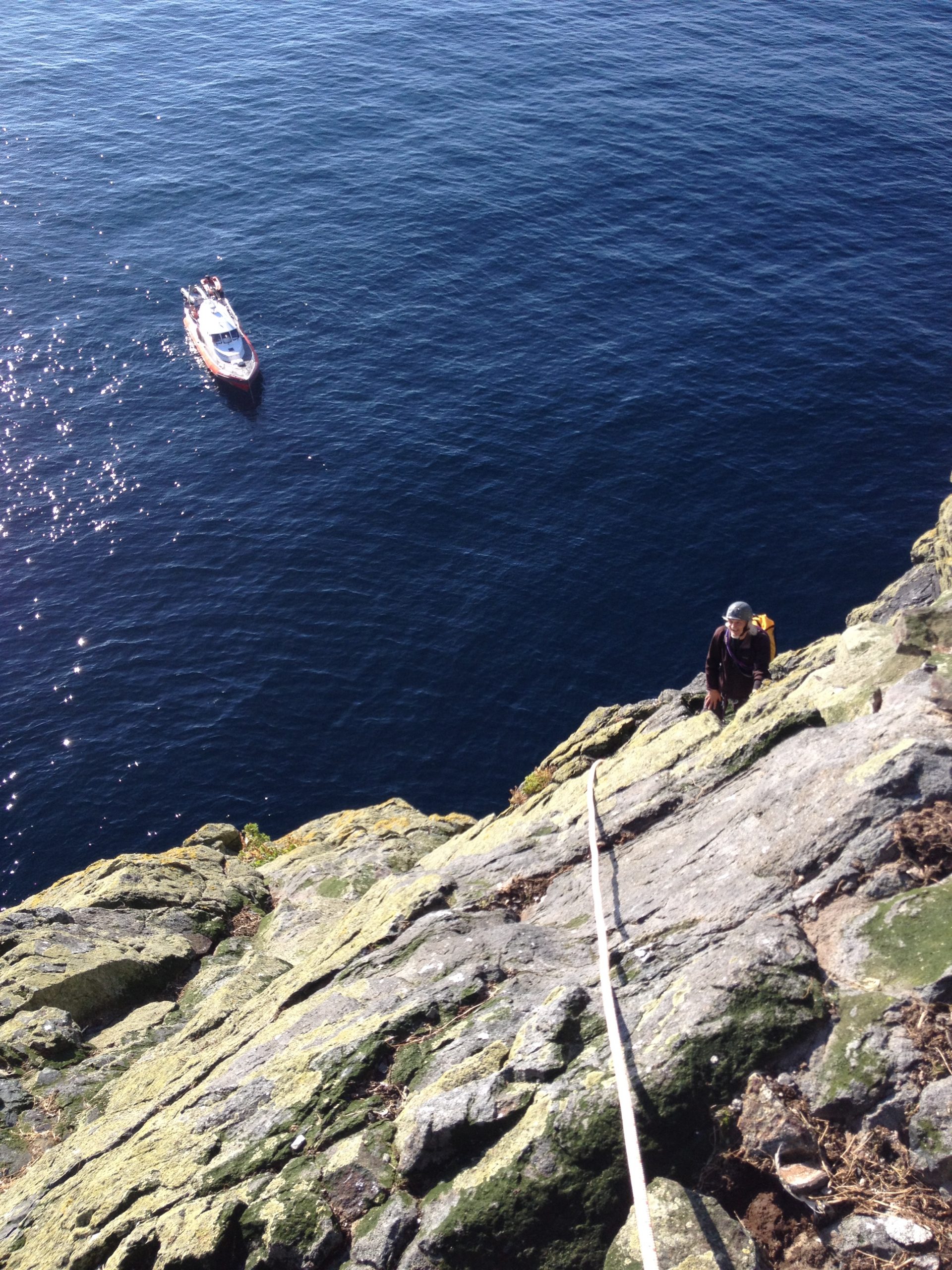
Beyond that, a narrow slanting gangway, littered with loose rocks. And finally, we were out onto the slopes leading to the summit. This area would be white with gannets in the summer months. All that remained now were their untidy nests and smelly guano. Step by careful step we weaved around the nests steeply approaching the topmost point. Reaching that summit was like a dream, something I had never imagined I would be able to achieve.
We stayed the night at village bay and were back out early the next morning for Stac an Armin. The weather was starting to break down. No sunshine that day, and the swell was picking up. The most difficult part for Stac an Armin was getting landed, and the initial roped climb up near-vertical rock to the grassy terraces above. There were further easy scrambling sections, interspersed with grass and plenty of guano. The view from the top across to the north end of Boreray was breathtaking, with all its monumental rock spires and pinnacles.
The return journey on The Enchanted Isle, skippered by Seumas Morrison, to Leverburgh was equally memorable. Arriving as the last light of the day slipped away I rested content in the knowledge that I had cracked the Kildan Marilyns. With just under 500 Marilyns remaining I could, with a lot of good planning and hard walking, become the first woman to complete this challenging set of hills.
There are over 200 Marilyns on islands around Scotland and the logistics of organising a trip to some of these is difficult. The Relative Hills Society plan hill bagging trips to Scottish islands each year.
The appeal of The Marilyns
The Marilyns stretch the length and breadth of Britain, from Saxa Vord on Unst (the most northerly island in The Shetlands) to Watch Croft (White Downs) in Cornwall, the most southerly hill. Cnoc Glas on Soay (St Kilda) is the most westerly hill, whilst Detling Hill in the North Downs is the most easterly.
In addition, the Marilyns include many historic hills which tell the story of Britain over the last ten thousand years. On Breabag in the far north of Scotland, there are caves that are 8,000 years old. On Penycloddiau in North Wales, remains of the largest and most complex hill fort in Wales dating back to the Bronze Age, are visible. Arthur’s Seat overlooking Edinburgh qualifies as a Marilyn and has a remarkable history, as do many other Marilyns.
Although the Marilyns were the first Relative Hills lists, further lists have now been completed including the Humps. These have one hundred metres of prominence rather than one hundred and fifty metres so there are nearly double the number of hills, 2,983 in total. Remarkably this list has been completed by Alan Whatley and Rob Woodall. They ascended their final Hump, the Old Man of Hoy, an extreme rock climb, in 2018. The Relative Hills Society is not expecting many others to complete this list!
Other Relative Hills lists include the Tumps (30m of prominence) with over 17,000 hills, and the SIBs (significant islands of Britain), as well as a number of international lists. If you want to explore Britain there is no better way to do it than to start climbing Relative Hills.

Add comment